Published On Aug 27, 2020
Ad-free video lessons. Hundreds of practice questions. $49
https://thedronecoach.io
Turn on Closed Captioning [cc] for important subtitle lesson updates.
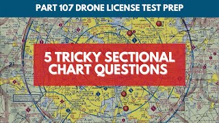
Applicable through 2024. Lesson #3 is 55 minute video that contains information on how to read and interpret aeronautical sectional charts, and the content within this video is valid and applicable through 2024.
This is not an easy lesson and nearly 50% of viewers quit before finishing. If you think this is difficult, you're only 1/3rd the way through it all.
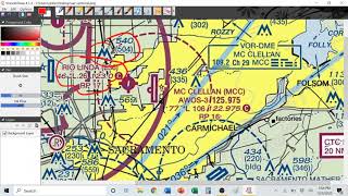
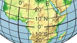
This lesson is perhaps one of the most important lessons you must know to pass the FAA Part 107 remote pilot airman knowledge exam. This lesson teaches students how to interpret and understand aeronautical charts, the various airspace classes, how to read latitude and longitude maps, plus much more.
NOTICE: page 2 of the sample review question should read "What is the height of the tallest GROUP of towers due south of Minot airport?" The FAA may refer to these as "clusters". Remember, the FAA will look for the answer that is MOST correct, even when all answers are not perfectly correct.
NOTICE: the quiz review at the end of the video, the correct answer to the Unicom frequency is 122.95, not 127.95. Garrison airport more closer to 47 degree, 41 minutes And the quadrant below 48 degrees N is 47 degrees, 30 minutes. 47 degrees is not shown on the map, and the FAA will throw trick questions like this at you.
Beginning July 1, 2021, the cost to sit for the initial Airman Knowledge Exam is $175. For additional information, visit: https://faa.psiexams.com/faa/login