
Published On Oct 10, 2021
This tutorial is part 10 of the OSINT At Home series. It covers how to make custom maps with publicly available data on anything. For example, you can create a map like this one I have created on public water fountains and public toilets in London, which I use to plan my runs: https://maphub.net/bendobrown/london-...
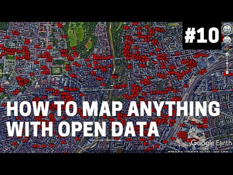
I have also included a few examples in the video, such as mapping CCTV cameras in Munich, or gas well sites in Australia. Please do look around the wiki that I have linked to, as there are lots of opportunities to collect and map data based on what you are investigating, researching, or interested in.
The tutorial specifically covers the use of Overpass Turbo, which allows you to query the Open Street Map (OSM) database and export those points as a KML, GPX, GeoJSON or other file types so that you can load it into Google Earth or any other map platform you use. I have also covered some frequently asked questions in this tutorial, such as how to put a kml or kmz file in Google Earth, which is as simple as a ‘drag and drop’, and I have also covered how you can upload these datasets into a free to use platform called MapHub, where you can create public or team maps for your hobbies, research or projects.
It should be noted that all data, from any source, should be verified before being relied upon. For example, I checked the locations of CCTV cameras or water drinking points by viewing them through Google Street view. However, there may be some limitations to it as some of those amenities might be closed or removed – so always good to check your data.
The OSINT At Home series is useful for those looking to find digital breadcrumbs and pick up some methods of open source intelligence (OSINT), digital investigations and good old plain research. No matter who you are, or where you are in the world, you can follow these tutorials from home with publicly available information to answer questions such as who, what, where and when.
TOOLS
Overpass Turbo: https://overpass-turbo.eu/
Open Street Map Wiki: https://wiki.openstreetmap.org/wiki/C...
Open Street Map Org: www.openstreetmap.org
Google Earth Pro: https://www.google.co.uk/earth/downlo...
MORE RESOURCES
NixIntel Part 1: https://nixintel.info/osint-tools/get...
NixIntel Part 2: https://nixintel.info/osint-tools/get...
Geojournalism: https://geojournalism.org/2013/08/how...
Towards Data Science: https://towardsdatascience.com/geospa...
SUPPORT ME:
Please do consider supporting this content so I can create more and keep it free, independent and accessible to everyone in the world: https://ko-fi.com/bendobrown
MY SETUP:
Apple Macbook Pro 16-inch: https://amzn.to/3rTWhW3
Logitech MX Anywhere 2 mouse: https://amzn.to/3phQp7v
Blue Yeti USB microphone: https://amzn.to/3ajixmb
CREDITS FOR THIS TUTORIAL
Imagery: Google Earth/Landsat Copernicus
Data: OpenStreetMaps
Music Intro: World’s Fair – God Mode
Music End: Dhaka by Kevin MacLeod is licensed under a Creative Commons Attribution 4.0 license. https://creativecommons.org/licenses/...
Source: http://incompetech.com/music/royalty-...
Artist: http://incompetech.com/
QUERIES AND CODE LINES USED IN THIS TUTORIAL
Drinking water search: amenity=drinking_water in London
Public toilet search: amenity=toilets in London
CCTV Camera search: man_made=surveillance in munich
Petroleum well search: man_made=petroleum_well
Drinking water style colouring
{{style:
node[amenity=drinking_water]
{ color:blue; fill-color:blue; }
}}