Published On Jul 19, 2021
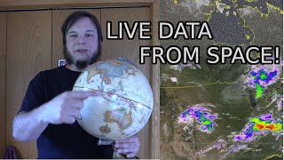
This tutorial is part 9 of the OSINT At Home series. It covers a common question that I get asked a lot, which is where I am getting my satellite imagery from. So I’ve made this tutorial on my four favourite satellite imagery sources and tools – and they’re all free.
This tutorial may suit you if you are keen to learn a little bit more about how and where to find satellite imagery for free. We all know commercial imagery can be expensive, so getting it for free is quite helpful.
If you are keen on learning more about geospatial intelligence (GEOINT), GIS, open source intelligence (OSINT), verification, geolocation or being able to visualise findings in research, journalism or movie making with satellite imagery, then you might find this tutorial helpful.
For those that don’t want to watch the whole video, below I have broken this tutorial down into chapters:
00:53 – Google Earth Pro (https://www.google.co.uk/earth/downlo...)
04:18 - Sentinel Hub (https://apps.sentinel-hub.com/sentine...)
08:11 - Zoom Earth (https://zoom.earth/) NOTE: Zoom Earth has updated imagery availability, use https://satellites.pro/ for clear hi-res satellite imagery instead.
11:08 - World Imagery Wayback (https://livingatlas.arcgis.com/wayback)
The OSINT At Home series is useful for those looking to find digital breadcrumbs and pick up some methods of open source intelligence (OSINT), digital investigations and good old plain research. No matter who you are, or where you are in the world, you can follow these tutorials from home with publicly available information to answer questions such as who, what, where and when.
FREE SATELLITE IMAGERY SOURCES
Google Earth Pro: https://www.google.co.uk/earth/downlo...
Sentinel Hub Playground: https://apps.sentinel-hub.com/sentine...
Zoom Earth: https://zoom.earth/ NOTE: Zoom Earth has updated imagery availability, use https://satellites.pro/ for clear hi-res satellite imagery instead.
World Imagery Wayback: https://livingatlas.arcgis.com/wayback
MORE RESOURCES
How to geolocate an image or find a location using satellite imagery: • OSINT At Home #4 – Identify a locatio...
How to create a satellite image timelapse: • OSINT At Home #7 – How to create a sa...
How to view past satellite imagery on Google Earth: • OSINT At Home #6 – Find when an image...
How to add KML/KMZ files to Google Earth and where to find them: https://benjaminstrick.com/geospatial...
15 Free Satellite Imagery Data Sources:
https://gisgeography.com/free-satelli...
Free Satellite Imagery Sources: https://eos.com/blog/free-satellite-i...
SUPPORT ME:
Please do consider supporting this content so I can create more and keep it free, independent and accessible to everyone in the world: https://ko-fi.com/bendobrown
MY SETUP:
Apple Macbook Pro 16-inch: https://amzn.to/3rTWhW3
Logitech MX Anywhere 2 mouse: https://amzn.to/3phQp7v
Blue Yeti USB microphone: https://amzn.to/3ajixmb
CREDITS FOR THIS TUTORIAL
Imagery: Google Earth/Landsat Copernicus
Satellite imagery: Copernicus Sentinel & Landsat data source acquired through the Sentinel Hub Sentinel Playground: https://apps.sentinel-hub.com/sentine..., Sinergise Ltd.
Microsoft Maps, ESRI Imagery
Music Intro: World’s Fair – God Mode
Music End: Dhaka by Kevin MacLeod is licensed under a Creative Commons Attribution 4.0 license. https://creativecommons.org/licenses/...
Source: http://incompetech.com/music/royalty-...
Artist: http://incompetech.com/