Researchocrat
4.39K subscribers
30:59
Prepare Elevation Map with Contour Lines in QGIS | Latest Tutorial
Researchocrat
440 views • 2 weeks ago
4:08
Calculate the Area Covered by Polygon Shapefiles in QGIS | Latest Tutorial
Researchocrat
106 views • 4 weeks ago
10:26
Reverse Geocoding in QGIS: Extract Location Details & Save as CSV | Latest Tutorial
Researchocrat
343 views • 1 month ago
12:54
Creating Bubble Map in QGIS | Tutorial 2024
Researchocrat
661 views • 2 months ago
15:12
Create HYSPLIT Particle Dispersion (PM2.5) Model In R
Researchocrat
417 views • 2 months ago
6:08
Change the Colour of a Polygon (Shapefile) and Save it in QGIS
Researchocrat
519 views • 3 months ago
20:36
Adding Coordinates into QGIS Map | Grids & Coordinates
Researchocrat
1.2K views • 4 months ago
5:14
Easy Steps to Convert KML to SHP (Shapefile) and Back in QGIS
Researchocrat
1.2K views • 4 months ago
26:28
Creating Shapefile and Study Area Map for any Location | Latest Tutorial using QGIS
Researchocrat
28K views • 4 months ago
31:00
Statistical Tests for Comparing Two Groups | Explanation and Implementation in R
Researchocrat
162 views • 5 months ago
23:34
PERMANOVA in R | Explanation and Implementation
Researchocrat
4.4K views • 6 months ago
16:39
Principal Component Analysis Tutorial & Interpretation Using R
Researchocrat
608 views • 6 months ago
8:08
Create an Interactive Leaflet Map in R Studio | Add Shapefiles & Pop-up texts
Researchocrat
1.3K views • 7 months ago
10:11
Calculating the Area covered by Pixel Classes Under a Polygon | QGIS Tutorial
Researchocrat
846 views • 7 months ago
5:04
Extract Features as Polygons from Openstreet Map in QGIS | QuickOSM Plugin
Researchocrat
2.4K views • 7 months ago
8:42
Download and Visualize Google Open Buildings Data| Earth Engine + QGIS
Researchocrat
3K views • 7 months ago
7:52
Create Heat Map and Density Polygons in QGIS
Researchocrat
10K views • 8 months ago
6:59
Spatial Interpolation (IDW)Tutorial Using QGIS
Researchocrat
11K views • 8 months ago
5:14
Cropping Raster using a Shapefile in QGIS | Clipping Raster
Researchocrat
3.6K views • 10 months ago
6:02
Download TROPOMI Air Quality Data from Google Earth Engine Without any Code | TROPOMI Explorer App.
Researchocrat
3.1K views • 10 months ago
11:16
Create HYSPLIT Wind Trajectory Models in R Studio | Tutorial
Researchocrat
1.6K views • 11 months ago
16:27
Perform Time Series Forecasting in R Studio | ARIMA & ETS Models
Researchocrat
5.2K views • 11 months ago
9:17
Create Windrose Diagram for any Location in R using NASA POWER Data
Researchocrat
5.1K views • 1 year ago
8:35
Importing Coordinates CSV file into QGIS and Labelling the Points
Researchocrat
12K views • 1 year ago
6:25
Why Researchers Must Learn R | RStudio
Researchocrat
755 views • 2 years ago
4:06
Getting World Shapefile and Selecting Individual Countries in QGIS
Researchocrat
30K views • 2 years ago
6:41
Customize plots using 'ggThemeAssist' - No codes required | R Studio
Researchocrat
392 views • 2 years ago
6:46
How to correct Spelling Mistakes in Data frames using R
Researchocrat
1.6K views • 2 years ago
13:58
How to add Grids of specified size with coordinates | QGIS
Researchocrat
29K views • 2 years ago
14:12
NMDS (Non-metric multidimensional scaling) Clearly Explained | R Studio
Researchocrat
16K views • 3 years ago
Load More

 30:59
30:59 4:08
4:08 10:26
10:26 12:54
12:54 15:12
15:12 6:08
6:08 20:36
20:36 5:14
5:14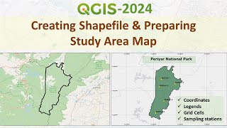 26:28
26:28 31:00
31:00 23:34
23:34 16:39
16:39 8:08
8:08 10:11
10:11 5:04
5:04 8:42
8:42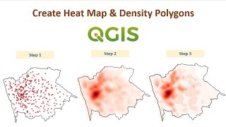 7:52
7:52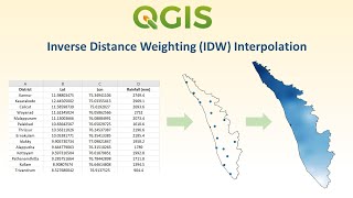 6:59
6:59 5:14
5:14 6:02
6:02 11:16
11:16 16:27
16:27 9:17
9:17 8:35
8:35 6:25
6:25 4:06
4:06 6:41
6:41 6:46
6:46 13:58
13:58 14:12
14:12