Published On Feb 12, 2024
"Most of the trees are just trees, of course; but many are half awake."
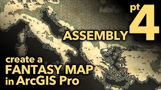
In this 4-part series we'll walk through the reckoning of a Lord of the Rings style fantasy map, right in ArcGIS Pro. We map-makers get to breathe honest to goodness geographic life into the seminal aesthetic found in the LOTR cartography, and I think that's a bit of magic just waiting around for us to wield.
The forest style of Christopher Tolkien's LOTR map insert is pretty distinctive and charmingly simple. In this video we'll apply that look to forest polygons in a Geographic Information System, and then we'll take it a step further by personalizing it a bit with some shade and tinting. Fantasy mapping for fun? Making custom D&D maps with read data? Mapping your municipality in an eye-catching and exciting way? Give it a go!
Here is a link to the graphical assets I made in this video if you'd prefer to use mine: https://adventuresinmapping.files.wor...
0:00 Pretty stunning intro
1:03 Deconstructing the forest components
1:27 Planting a forest perimeter
2:36 Filling in the forest with a repeating pattern
3:42 Those cute little tree trunks
5:01 Giving this map a paper texture
5:42 Personalizing with some shading and tinting
10:15 Save symbol to a re-usable style
If you just can't get enough fantasy mapping, check out Wes Jones' channel, where he teaches you how to draw them from scratch: / @fantasymapping
Check out some other social channels where I share how-to's and updates on random map adventures:
http://adventuresinmapping.com
https://www.esri.com/arcgis-blog/auth...
/ john_m_nelson
/ johnmnelson
/ johnmnelson
Music: Venkatesananda - Jesse Gallagher