Published On Nov 4, 2022
For contractors who have a site to layout, there’s now a robot for that.
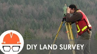
On this episode of The Dirt, we hear from Civ Robotics, makers of the autonomous surveyor CivDot.
Company founder and CEO Tom Yeshurun saw a big need for autonomous surveying, to show contractors where to build and what to build according to the blueprints.
The four-wheel-drive CivDot marks coordinates on the ground with paint that a worker following behind then marks with a stake. It also records ground elevation for how much dirt to add or how much to remove. It can travel all types of terrain.
Some popular uses of the robot include heavy civil projects such as pipelines, foundations and road striping and markings.
So to learn more about CivDot, the layout robot, check out this week’s episode of The Dirt.
Equipment World serves up weekly videos on the latest in construction equipment, work trucks and pickup trucks – everything contractors need to get their work done. Subscribe and visit us at equipmentworld.com!
In This Episode
00:00 - What is Civ Robotics?
01:05 - Grade Staking Automation
01:40 - How Does a CivDot Work?
02:38 - How Does a CivDot Mark Points?
03:18 - Why Does a CivDot Only Do Layouts?
04:09 - Compatible Terrain Types
05:07 - How Much Does a CivDot Weigh?
05:38 - Battery Capacity: How Long Can a CivDot Run?
07:12 - How Do You Operate a CivDot?
08:53 - Can a CivDot Do Terrain Mapping?
09:50 - Is a Base Station Required?
11:12 - Required Training to Use a CivDot
12:05 - How a CivDot Can Save You Time and Money
12:53 - How Fast Does a CivDot Move?
13:12 - Why Operators Like CivDots
13:43 - Best Types of Projects for a CivDot
14:50 - Final Thoughts & Outro
Video Transcript:
Bryan Furnace:
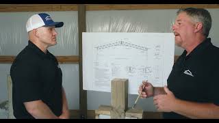
Hi everybody. Welcome back to Equipment World. You're watching the Dirt. I'm your host Bryan, and today we're here to talk about some more surveying things on an autonomous level. But we're not going to the skies today with drones, we're going to stay on the ground with Civ Robotics. Today, we have Tom Yeshurun from Civ Robotics here to tell us about a layout tool that could absolutely change your business.
Tom Yeshurun:
So I came from a construction background, and we saw a big need for automation of surveying, and specifically layouts. So our product is doing autonomous layouts, guiding contractors where to build in what according to the blueprints. Literally, marking coordinates on the ground with paint, and then nails, and whiskers, or stakes, and providing the contractor clear instruction of what to do at that point. If it's installing a pile of type A, if it's striping the road with dashed lines or solid lines, or putting a stop sign in the intersection, anything can be marked with it using our machine.
Bryan:
Now, can you put in grade stakes and mark those appropriately? Because that's where a lot of surveyors struggle.
Tom Yeshurun:
Yeah. Look, as a civil engineer in the road construction, we did a lot of grade checking and a lot of grade staking. Our machine lays out the coordinates and provides the grade elevation of the ground, and it can tell you how much to fill or to cut based on the ground elevation. And then the person mainly has to put that information on the stake, and they might have to do some offsets, but we provide the clear information to the surveying professional in the field or to the APCs directly. It's a tool.
Bryan:
So just to kind of give people an idea, and myself included, I'm assuming you kind of load your model into the little rover, and then you kind of tell it where it is in space. And then it goes and runs its program. Is that kind of the gist of how that works?
Tom Yeshurun:
Kind of. From the model, if using Trimble, or Topcon, or any other software of surveyors, you can export a list of coordinates that you want to lay out, usually known as CSV. It could be LA Long North and Easting. And we upload that to our machine, and we press start. And if you want to create a certain path, certain direction, you want to go northeast, north-south, or east-west, you can choose that on our platform and it will create the most efficient route to do so. And as it marks the coordinates, it also takes a high quality shot of elevation and provides that to the user in real time if they want to do for cut and fill, or later for quality assurance if you just want to do grade checking for instance.
Bryan:
Interesting. And you said this has the ability to mark and paint, or you can actually shoot a nail with whiskers into the ground?
Tom Yeshurun:
We've actually done the installation of physical stakes in the past. We no longer really offer that. But most of our customers, what they do is, they follow the machine and hammer the nail and the stakes right afterwards. So we basically show them where to do it. And the size of the spray paint is the same diameter as the pull of the survey. So the survey crew usually goes and basically puts that dent in...