Published On Feb 19, 2024
Time-lapse drive to the summit and then hiking around. Trip took place back in September 2023.
More about Pikes Peak:
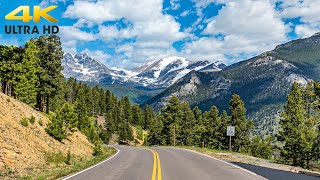
Pikes Peak is the highest summit of the southern Front Range of the Rocky Mountains in North America. The ultra-prominent 14,115-foot (4,302.31 m) fourteener is located in Pike National Forest, 12 miles (19 km) west of downtown Colorado Springs, Colorado. The town of Manitou Springs lies at its base.
The mountain is named in honor of American explorer Zebulon Pike (though he was unable to reach the summit). The summit is higher than any point in the United States east of its longitude.
The band of Ute people who called the Pikes Peak region their home were the Tabeguache, whose name means the "People of Sun Mountain".[5] Tava or "sun", is the Ute word that was given by these first people to the mountain that we now call Pikes Peak. (In contrast, the name Tabeguache Peak is now used for a peak further west.) It is thought that the Ute people first arrived in Colorado about 500 A.D.,[citation needed] however their oral history states that they were created on Tava. In the 1800s, when the Arapaho people arrived in Colorado, they knew the mountain as Heey-otoyoo' meaning "Long Mountain".[6]
Throughout its history, European peoples have called the mountain El Capitán, Grand Peak, Great Peak, James Peak, Long Mountain, and Pike's Peak.[3]
Early Spanish explorers named the mountain "El Capitán," meaning "The Leader". American explorer Zebulon Pike named the mountain "Highest Peak" in 1806, and the mountain was later commonly known as "Pike's Highest Peak." American explorer Stephen Harriman Long named the mountain "James Peak" in honor of Edwin James who climbed to the summit during Long's Expedition of 1820. The mountain was later renamed "Pike's Peak" in honor of Pike. The name was simplified to "Pikes Peak" by the United States Board on Geographic Names in 1890. '
ikes Peak is one of Colorado's 54 fourteeners, mountains more than 14,000 feet (4,267.2 m) above sea level. The massif rises over 8,000 ft (2,400 m) above downtown Colorado Springs. Pikes Peak is a designated National Historic Landmark. It is composed of a characteristic pink granite called Pikes Peak granite. The color is due to a large amount of potassium feldspar.
It is thought that the granite was once magma that crystallized at least 20 miles (32 km) beneath the Earth's surface, formed by an igneous intrusion during the Precambrian, approximately 1.05 billion years ago, during the Grenville orogeny. Through the process of uplifting, the hardened rock pushed through the Earth's crust and created a dome-like mountain, covered with less resistant rock. Years of erosion and weathering removed the soil and rock leaving the exposed mountain.
Soils on Pikes Peak above the timberline (approximately 12,000 ft or 3,700 m) are classified as Cirque land. Forests at lower altitudes mostly lie over the brown stony, sandy, loams of the Catamount loam or Ivywild loam series.[7]
The Devils Playground is a minor subpeak of Pikes Peak located on the northwest side of the mountain near the Pikes Peak Highway. The Devils Playground is named for the way lightning sometimes dances around the prominence during lightning storms. The Devils Playground is the highest point in Teller County at an approximate elevation of 13,075 feet (3,985 m).