Published On Feb 12, 2022
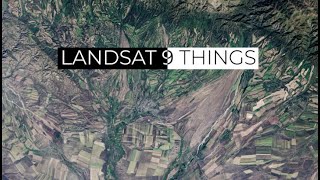
Using multispectral satellite data from Landsat 9 in QGIS to create color imagery of high quality.
Also try a virtual raster for R-G-B and then the processing tool GDAL-Pansharpening to enhance it with the pancromatic band. A bit more complex, but in most cases it will get you a better result.
https://earthexplorer.usgs.gov/
Want to learn more about Landsat 9:
• Landsat 9 At Work
show more