Published On Nov 27, 2021
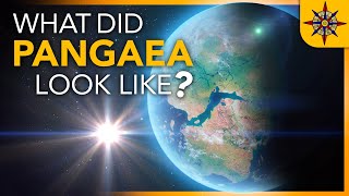
Professor James Cheshire talks about maps from his book "Atlas of the invisible". Iceberg A-68 was a giant tabular iceberg adrift in the South Atlantic, having calved from Antarctica's Larsen C ice shelf in July 2017. By 16 April 2021 no significant fragments remained. With a surface area of 5,800 square kilometres (2,200 sq mi), twice the size of Luxembourg, it was one of the largest recorded icebergs, the largest being B-15 which measured 11,000 square kilometres (4,200 sq mi) before breaking up. The calving of A-68 reduced the overall size of the Larsen C shelf by 12 percent. James Cheshire talks about the map from his book that tracks the movement of A-68 and the importance of maps.
James Cheshire is Professor of Geographic Information and Cartography in the UCL Department of Geography and Director of the UCL Q-Step Centre. He is co-author of the critically acclaimed books London: The Information Capital and Where the Animals Go. James is the recipient of a number of major awards from the Royal Geographical Society, The North American Cartographic Information Society and British Cartographic Society. He was President of the Society of Cartographers between 2017 and 2019. His research focuses on the use of “big” and open datasets for the study of social science. He has published in a range of journals on a variety of topics including the use of cycle hire schemes, the spatial analysis of surnames and new ways to visualize population data.
For more cool science visit:
• Website: https://www.scienceandcocktails.org
• Facebook: / scienceandcocktailscph
• Youtube: / sciencecocktails
• Instagram: / scienceandcocktailsglobal