Published On Sep 7, 2015
005 - Water Resources
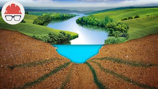
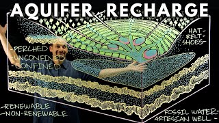
In this video Paul Andersen explains how water is unequally distributed around the globe through the hydrologic cycles. Seawater is everywhere but is not useful without costly desalination. Freshwater is divided between surface water and groundwater but must me stored and moved for domestic, industrial, and agricultural uses. Subsidized low cost water has created a problem with water conservation but economic changes could help solve the problem.
Do you speak another language? Help me translate my videos:
http://www.bozemanscience.com/transla...
Music Attribution
Intro
Title: I4dsong_loop_main.wav
Artist: CosmicD
Link to sound: http://www.freesound.org/people/Cosmi...
Creative Commons Atribution License
Outro
Title: String Theory
Artist: Herman Jolly
http://sunsetvalley.bandcamp.com/trac...
All of the images are licensed under creative commons and public domain licensing:
“Center Pivot Irrigation.” Wikipedia, the Free Encyclopedia, August 20, 2015. https://en.wikipedia.org/w/index.php?....
“Desalination.” Wikipedia, the Free Encyclopedia, September 4, 2015. https://en.wikipedia.org/w/index.php?....
File:LevelBasinFloodIrrigation.JPG, n.d. https://commons.wikimedia.org/wiki/Fi....
Hillewaert, Hans. English: Aquifer (vectorized), May 25, 2007. en:Image:Schematic aquifer xsection usgs cir1186.png. https://commons.wikimedia.org/wiki/Fi....
Ikluft. Aerial Photo of the California Aqueduct at the Interstate 205 Crossing, Just East of Interstate 580 Junction., September 11, 2007. Own work. https://commons.wikimedia.org/wiki/Fi....
Kbh3rd. English: Map of Water-Level Changes in the High Plains/Ogallala Aquifer in Parts of Colorado, Kansas, Nebraska, New Mexico, Oklahoma, South Dakota, Texas, and Wyoming, 1980 to 1995., February 27, 2009. Own work. https://commons.wikimedia.org/wiki/Fi....
moyogo, Water_Cycle_-_blank svg: *Wasserkreislauf png: de:Benutzer:Jooooderivative work: Water Cycle, SVG from Wasserkreislauf.png, November 13, 2011. Water_Cycle_-_blank.svg. https://commons.wikimedia.org/wiki/Fi....
NCDC/NOAA, Michael Brewer. English: Status of Drought in California, October 21, 2014., October 23, 2014. http://droughtmonitor.unl.edu/MapsAnd.... https://commons.wikimedia.org/wiki/Fi....
“Ogallala Aquifer.” Wikipedia, the Free Encyclopedia, July 20, 2015. https://en.wikipedia.org/w/index.php?....
Plumbago. English: Annual Mean Sea Surface Salinity from the World Ocean Atlas 2009., December 5, 2012. Own work. https://commons.wikimedia.org/wiki/Fi....
Rehman, Source file: Le Grand PortageDerivative work: English: The Three Gorges Dam on the Yangtze River, China., September 20, 2009. File:Three_Gorges_Dam,_Yangtze_River,_China.jpg. https://commons.wikimedia.org/wiki/Fi....
Service, Photo by Jeff Vanuga, USDA Natural Resources Conservation. Level Furrow Irrigation on a Lettuce Field in Yuma, Az., October 4, 2011. USDA NRCS Photo Gallery: NRCSAZ02006.tif. https://commons.wikimedia.org/wiki/Fi....
Station, Castle Lake Limnological Research. Castle Lake, California, January 14, 2008. [1]. https://commons.wikimedia.org/wiki/Fi....
Tomia. Hydroelectric Dam, December 30, 2007. Own work. https://commons.wikimedia.org/wiki/Fi....
USGS. English: Graph of the Locations of Water on Earth, [object HTMLTableCellElement]. http://ga.water.usgs.gov/edu/waterdis... - traced and redrawn from File:Earth’s water distribution.gif. https://commons.wikimedia.org/wiki/Fi....
version, Original uploader was Sagredo at en wikipedia Later. English: These Images Show the Yangtze River in the Vicinity of the Three Gorges Dam, September 29, 2007. Transferred from en.wikipedia; transferred to Commons by User:Rehman using CommonsHelper. https://commons.wikimedia.org/wiki/Fi....
“WaterGAP.” Wikipedia, the Free Encyclopedia, April 22, 2014. https://en.wikipedia.org/w/index.php?....
“Water in California.” Wikipedia, the Free Encyclopedia, August 31, 2015. https://en.wikipedia.org/w/index.php?....