Published On Dec 28, 2023
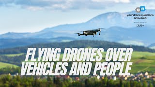
Welcome back to another episode of "Your Drone Questions Answered". Today's question comes from a person dealing with construction near railway lines, seeking precise measurements to ensure track stability during excavation. The client currently uses Trimble Total Station devices and wonders if drones could provide the required millimeter-level accuracy. Zachary Radel, Southwest Business Development Manager and Certified Mapping Specialist at Cooper Aerial, joins the discussion.
Jim Crume Linked In Profile - / jim-crume-p-l-s-m-s-cfeds-rp-5268991a
Where to get the Books - www.cc4w.net
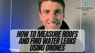
Zachary shares insights into the challenges of achieving millimeter accuracy with drones due to factors like motion, sensor limitations, and airborne GPS. He emphasizes the importance of clean sensors and lenses for accurate data collection. Discussing the specific scenario of monitoring railway tracks, Zachary mentions that current drone technology falls short of achieving the one to nine millimeter accuracy required by the client.
The conversation delves into the technical aspects of sensors, cameras, and LiDAR for mapping purposes. Zachary advises aspiring professionals in the drone mapping industry to prioritize safety, meticulous planning, and adherence to checklists. He emphasizes the significance of following standards set by organizations like the American Society for Photogrammetry and Remote Sensing (ASPRS).
Listeners are encouraged to submit their own questions through ydqa.io or the Drone Launch Connect community. As the episode concludes, John expresses gratitude to Zachary and invites him back for future discussions on mapping-related topics.